Services
Drone
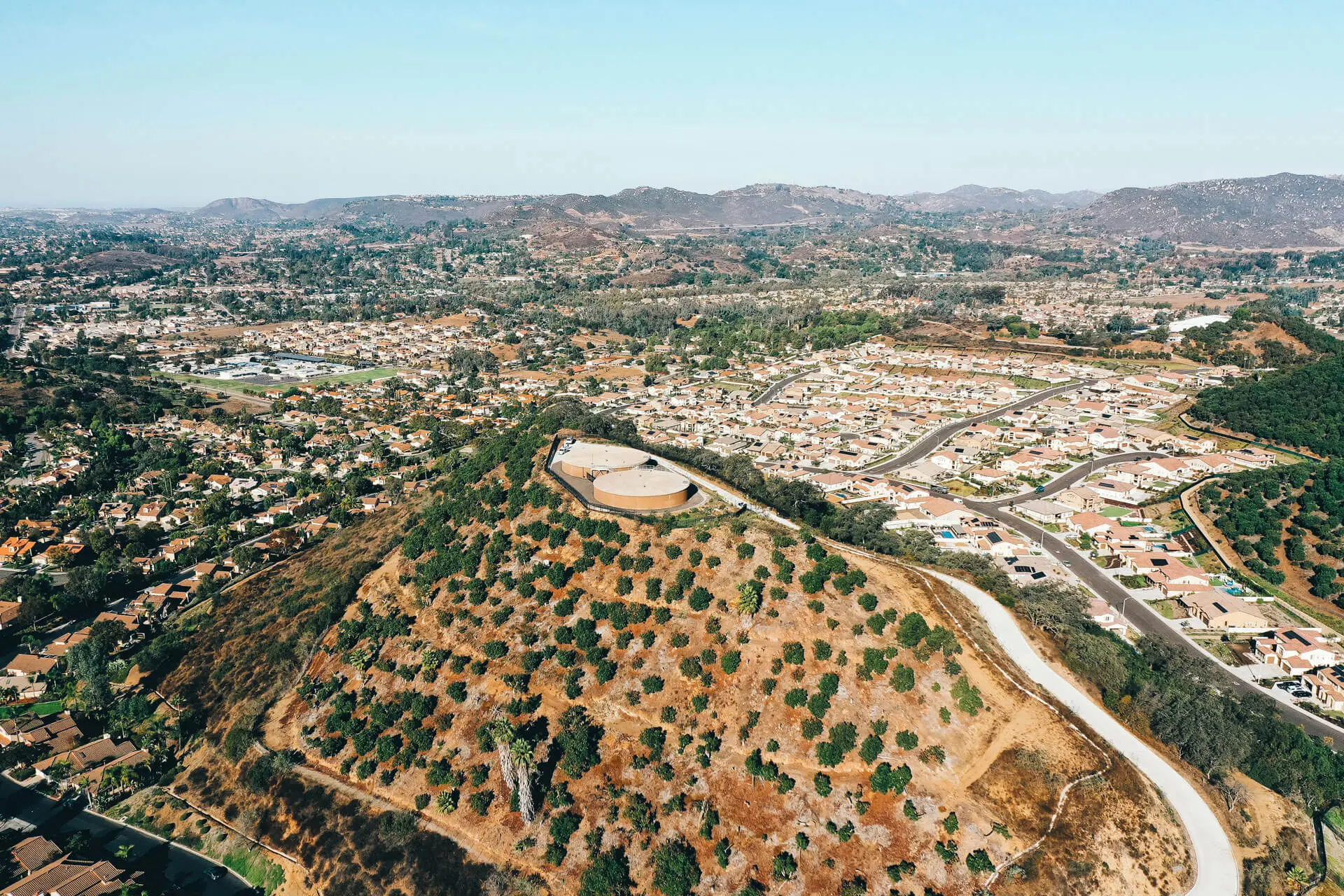
Get a bird’s-eye view of your projects with our drone service. Perfect for tracking progress, identifying potential issues, and capturing stunning visuals, our drones provide the perspective you need to stay ahead.

Aerial Views
Your Project Covered From Ground to Sky
Ensure every angle of your project is documented with precision and clarity. Our drone services provide high-quality aerial footage, offering a comprehensive view of your site that’s impossible to achieve from the ground.
Construction documentation from a unique perspective
Cover any disputes of larger projects
Overhead views for progress reporting
Promotion
Showcase Your Craftsmanship With a Unique Perspective
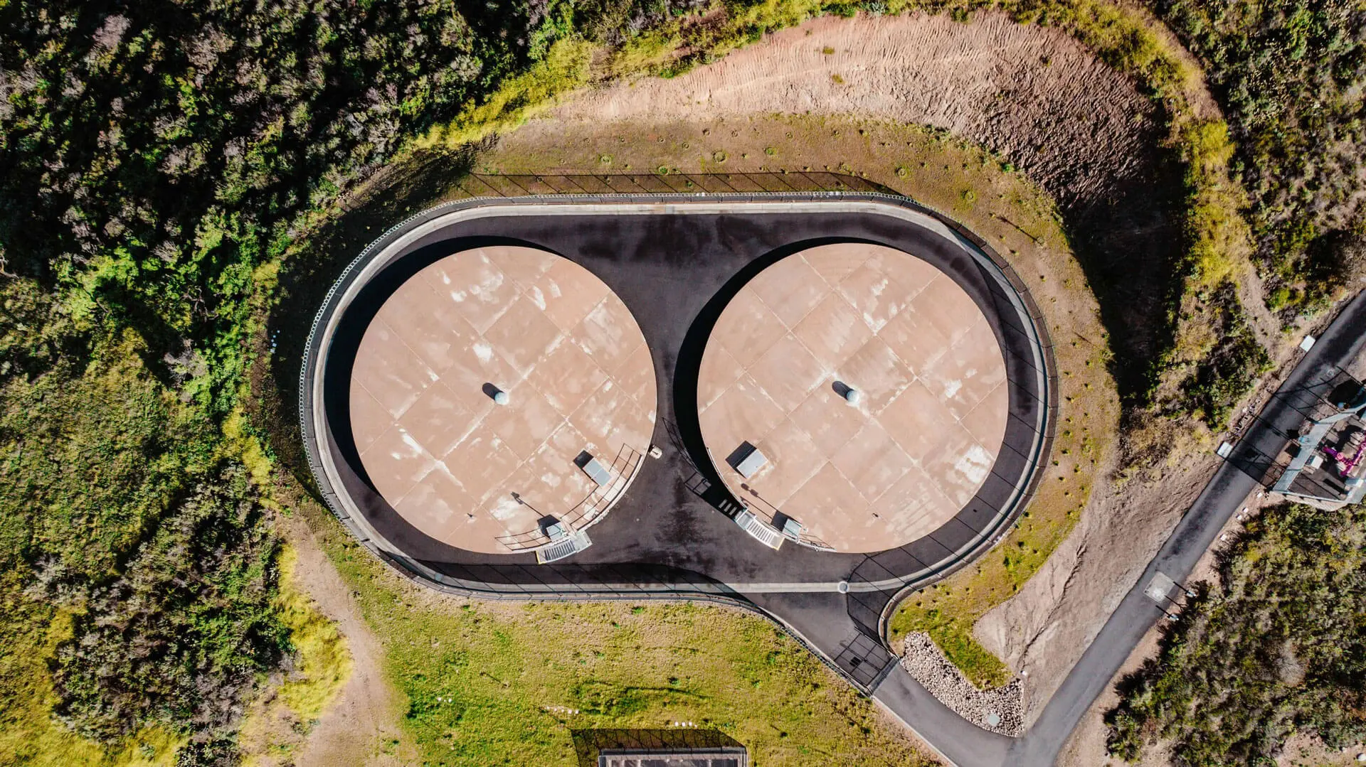
Elevate your project’s story with stunning aerial footage that highlights the scale and craftsmanship of your work. Drones capture breathtaking views that make your portfolio stand out and leave a lasting impression. Perfect for marketing, client presentations, or showing off your expertise, this perspective showcases your work like never before.
Inspection
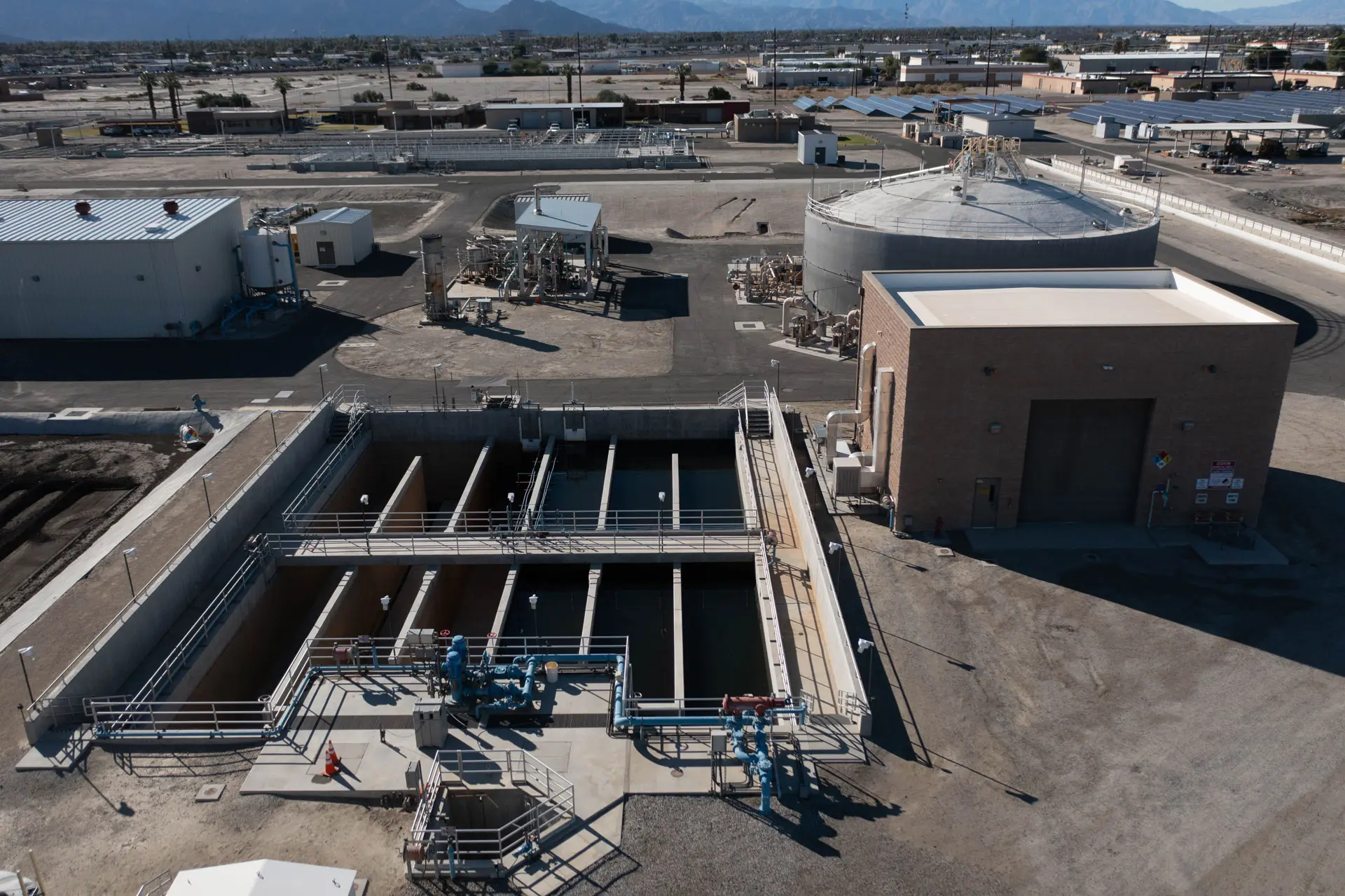
Analyze Key Potential Problem Areas From a Safe Distance
Identify potential issues without putting your team at risk using our drone inspection services. Capture detailed visuals of hard-to-reach or hazardous areas, enabling thorough analysis and informed decision-making. Maintain safety while staying proactive in addressing critical project concerns.
Mapping
Precision Mapping for Smarter Project Management
Create accurate 3D models and volumetric maps of your construction sites with our advanced drone technology. From calculating material volumes to planning sites, our mapping services deliver the data you need to streamline operations and make informed decisions.
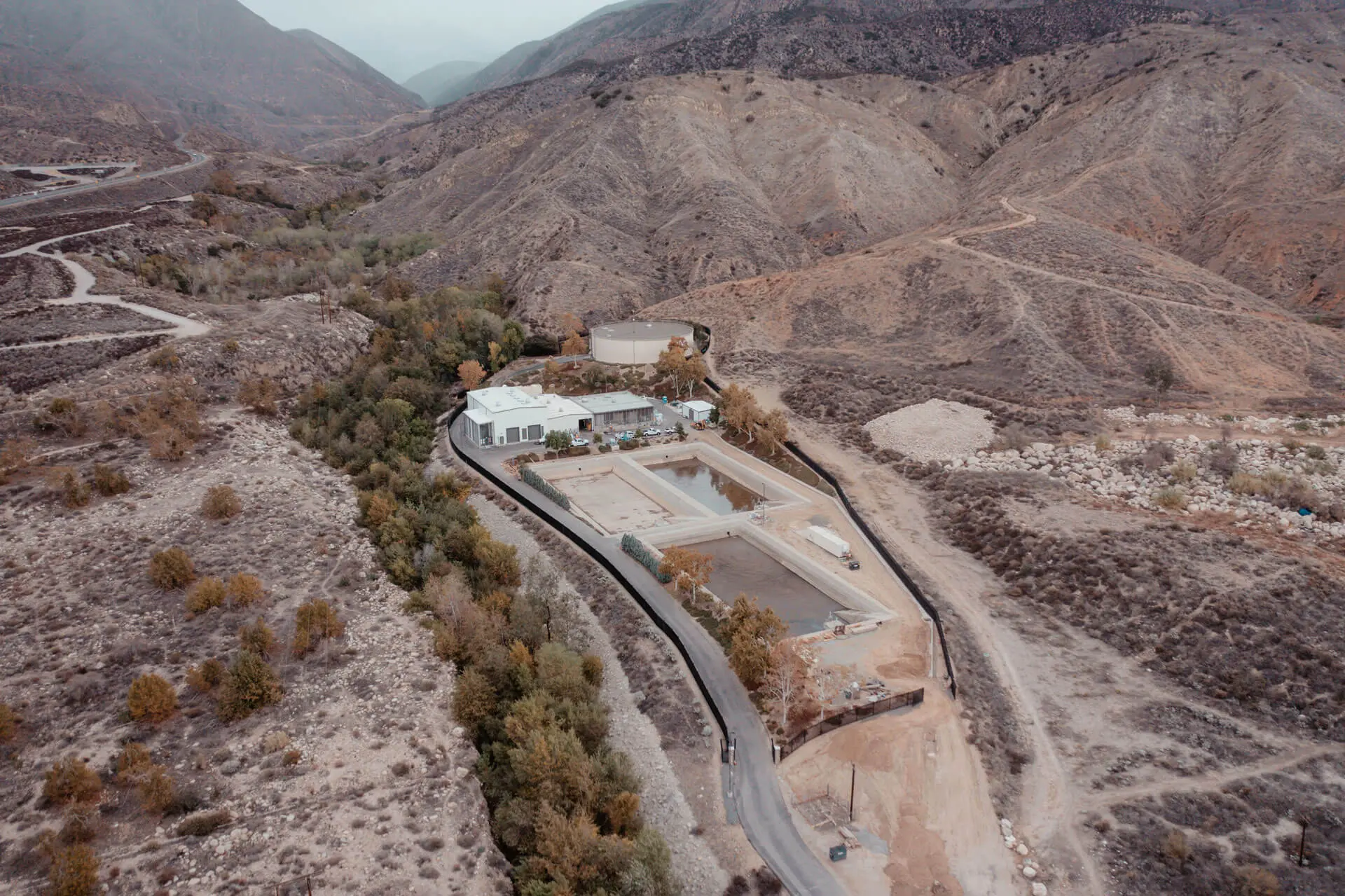
Volumetric Maps
Quickly estimate quantity of material using accurate volumetric maps to accurately determine manpower, material delivery or removal.
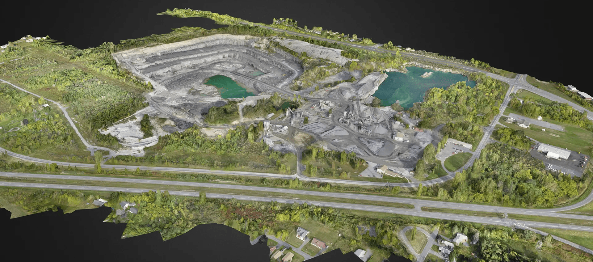
3D Mapping
Create precise models of job sites with millimeter-level accurate 3D mapping, using LiDAR technology to produce GPS-integrated maps for unmatched accuracy.

Drone
Services:
Aerial Documentation
LiDAR Scanning
3D Models
Volumetrics
Photogrammetry